Monaco Spatial & Visual Atlas · Research Area
18 Spatial Cases · 50 Visual Assets · Final Empirical Release
Nautical luxury, public circulation and differentiated access along Monaco’s principal harbour.
This territorial profile examines Port Hercule as an interface between public space, harbour infrastructure and nautical luxury, with particular attention to yacht visibility, longitudinal circulation along the quays, access to pontoons, and the devices regulating the transition from public promenade to controlled or private harbour space.
Spatial Profile
Nautical Luxury as Visible Landscape and Regulated Space
Port Hercule has a spatial configuration distinct from that observed in Monte Carlo’s ceremonial core. Much of the nautical luxury remains exceptionally visible from public promenades and routes: superyachts, other vessels and harbour infrastructure can be observed at close range.
However, this visual continuity does not imply continuity of access. Gates, pontoons, signage, physical controls, staff, property boundaries and temporary rules create units with differing conditions of approach, entry, staying and participation.
The matrix makes it possible to analyse precisely this divergence without treating the harbour as a homogeneous unit. A public promenade, a pontoon access point, a commercial terrace and the threshold of a private yacht constitute distinct Spatial Cases.
Area Overview
Empirical Base
Area Boundary: the Yacht Club de Monaco constitutes a separate analytical family within the Atlas, and its 3 cases and 5 assets are not included in these Port Hercule totals.
Spatial Structure
Territorial and Functional Subareas
The 18 cases are distributed across promenades, quays, harbour access points, commercial interfaces and transitional units linking urban circulation, the marina and vessels.
Port Hercule · General Interface
3 cases
General panorama, public visibility of superyachts, secondary pontoon access and private yacht access.
Quai Albert Ier
1 case
Public promenade and interface with yachts under spatial and temporal conditions of control.
Quai Louis II
3 cases
Public promenade, marina visibility and representative pontoon access systems.
Quai des États-Unis
2 cases
Promenade, terraces, vessel visibility and differentiated pontoon access.
Quai l’Hirondelle
2 cases
Public promenade and terrace boundary in relation to harbour circulation.
Quai Antoine Ier
2 cases
Interface with the water and vessels, and a representative harbour access point.
Quai Rainier Ier
1 case
Public promenade subject to observable temporary conditions during certain periods.
Jetée Lucciana
1 case
External route and longitudinal view towards the harbour and vessels.
Quai Rainier III
1 case
Cruise terminal and interface between harbour infrastructure and public circulation.
Hospitality Interfaces
2 cases
Le Pattaya and Wine Palace Monte-Carlo: terraces, access, furniture, consumption and economic conditions.
VAM Area Profile
Final Visibility and Accessibility Profile
The 18 Port Hercule cases have final V1–V5 and A1–A5 scores. The aggregated values below summarise the area but do not replace the assessment of each individual spatial unit.
Mean Visibility
High
Mean Accessibility
High
Mean Dimension Scores · 0–4
Matrix Configuration Distribution
61.1% of area cases
22.2% of area cases
16.7% of area cases
No final cases were recorded in the categories Discreet Accessibility or Enclosed Privilege within this area.
SECP Area Profile
Reviewed Opportunity Structure
The 18 cases generate 216 Case × Category combinations. Assessment opportunity and the final determination of mechanism presence are treated as independent decisions.
Observable Spatial Mechanisms
How the Port Operates Spatially
Nautical Visibility
Yachts and superyachts remain widely visible from numerous public circulation areas.
Pontoon Access
Gates and differentiated access points mark the transition between public promenades and berthing areas.
Longitudinal Circulation
The quays organise extended routes along which different access conditions occur in succession.
Rules & Signage
Signs, identification requirements, opening hours and rules document certain conditions of use or access.
Temporal Control
Events, accreditation requirements and temporary arrangements can alter the harbour’s ordinary access regime.
Human Mediation
Security staff and harbour personnel may intervene at certain transition points.
Commercial Interfaces
Restaurants and terraces introduce their own functional, spatial and economic conditions.
Private Yacht Interface
Visual proximity to a vessel may coexist with an explicit prohibition on crossing its threshold.
Evidence Rule
From Visual Evidence to Empirical Decision
A photograph or video may serve as Supporting Context or Candidate Occurrence Evidence, but these documentary relationships do not amount to confirmed presence. Final decisions are drawn from the reviewed empirical record.
Earlier OP codes are not published. Traceability is maintained through Asset ID, Case ID, Evidence Code, VAM dimensions and final SECP status.
Representative Cases
Selected Empirical Profiles
The following cases enable comparison of highly permeable promenades, pontoon access points, commercial interfaces, temporary controls and private spaces within the same harbour system.
VAM-MC-081
Port Hercule — General Panorama
V 95 · A 95
Publicly Permeable Luxury
Confirmed SECP: SE5 · SE12
Reviewed absence: SE4 · SE10
VAM-MC-087
Quai Albert Ier
V 85 · A 70
Publicly Permeable Luxury
Confirmed SECP: SE1 · SE8 · SE9 · SE10 · SE11
Reviewed absence: SE4 · SE12
VAM-MC-091
Quai Louis II — Pontoon Access System
V 70 · A 30
Displayed but Restricted Luxury
Confirmed SECP: SE1 · SE2
VAM-MC-093
Quai des États-Unis — Public Promenade
V 100 · A 95
Publicly Permeable Luxury
Reviewed absence: SE4
VAM-MC-097
Quai des États-Unis — Pontoon Access
V 75 · A 30
Displayed but Restricted Luxury
Reviewed absence: SE1 · SE2
VAM-MC-104
Secondary Pontoon Access & Temporal Control
V 50 · A 25
Conditional or Graduated Permeability
Confirmed SECP: SE1 · SE5 · SE11 · SE12
Reviewed absence: SE2 · SE10
VAM-MC-107
Quai Antoine Ier — Controlled Port Access
V 65 · A 30
Displayed but Restricted Luxury
Confirmed SECP: SE1 · SE2
VAM-MC-114
Le Pattaya
V 75 · A 70
Publicly Permeable Luxury
Confirmed SECP: SE3 · SE4 · SE6
VAM-MC-112
Quai Rainier III — Cruise Terminal
V 70 · A 40
Conditional or Graduated Permeability
Confirmed SECP: SE2
VAM-MC-143
Private Yacht Threshold
V 55 · A 0
Conditional or Graduated Permeability
Confirmed SECP: SE7
Reviewed absence: SE5
Selected Photographic Evidence
Traceable Static Evidence
The following photographs are a selection from the area archive. The published SECP statuses reflect final reviewed decisions, rather than merely the candidate categories initially associated with each asset.
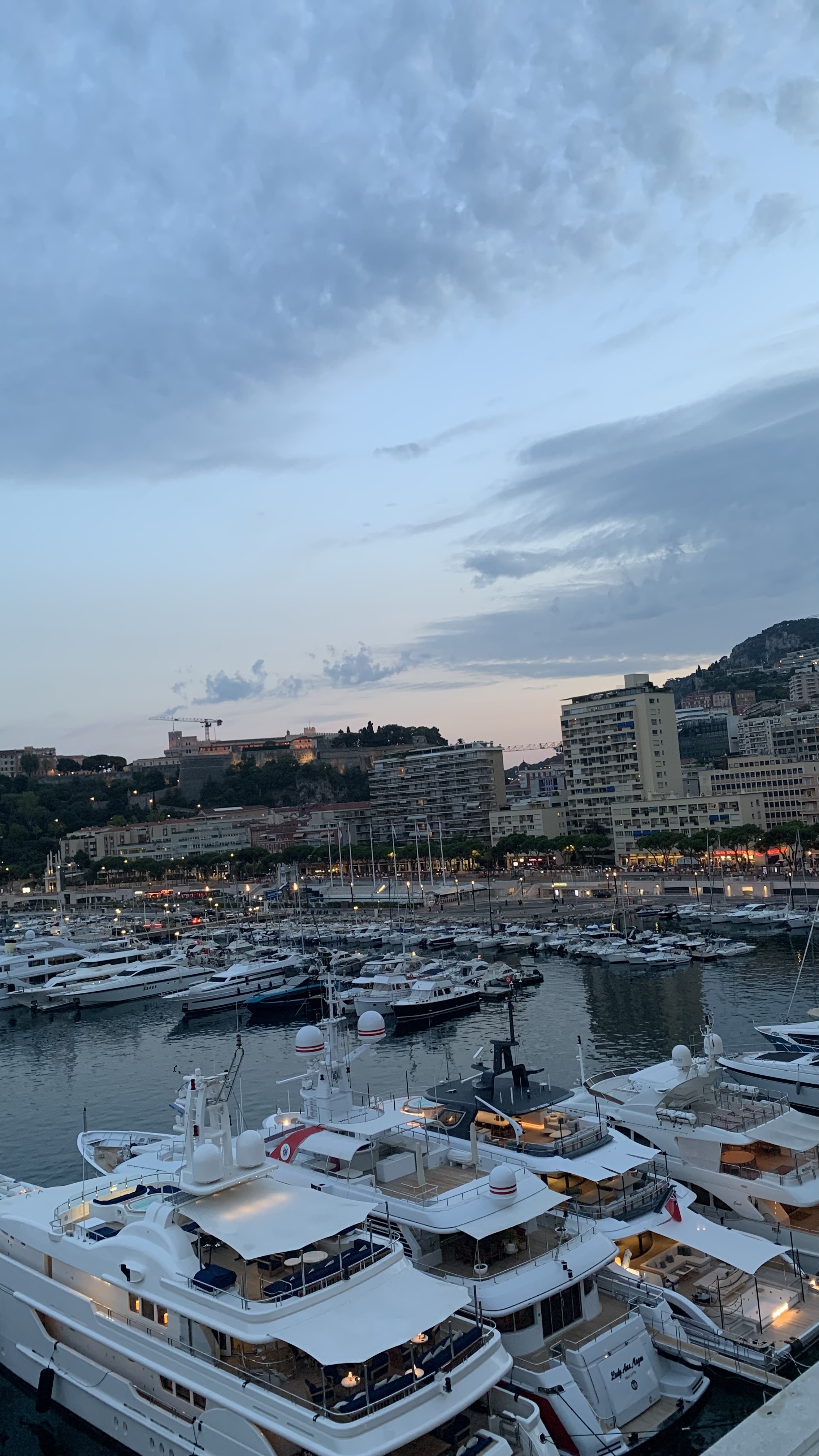
Port Hercule — general panorama from the Monte Carlo side.
Evidence: Photograph · CTX
VAM Dimensions: V1 · V2 · V4 · V5
SECP Status: Reviewed absence SE4. The visibility of superyachts did not, by itself, confirm Visual and Symbolic Signalling.
© Xavier Reinaldo-Virgili · Monaco Visual Fieldwork Archive
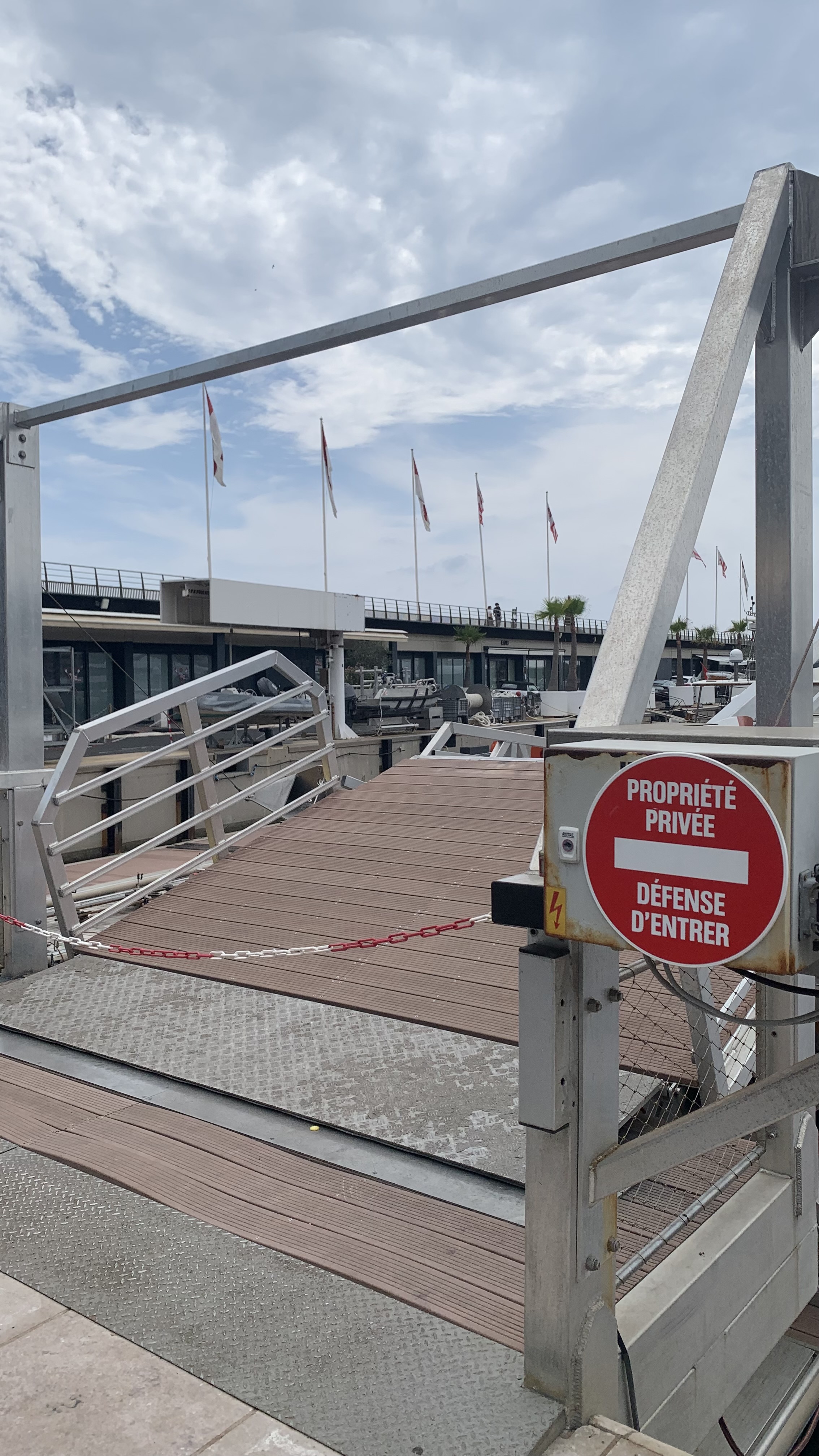
Port Hercule — signage and temporary regulation.
Evidence: Photograph · RUL
VAM Dimensions: A3 · A4 · A5
SECP Status: Confirmed SE5 · SE12; Reviewed absence SE10.
© Xavier Reinaldo-Virgili · Monaco Visual Fieldwork Archive
Quai Albert Ier — threshold and spatial transition.
Evidence: Photograph · THR
VAM Dimensions: A1 · A5
SECP Status: Confirmed SE1 · SE11.
© Xavier Reinaldo-Virgili · Monaco Visual Fieldwork Archive
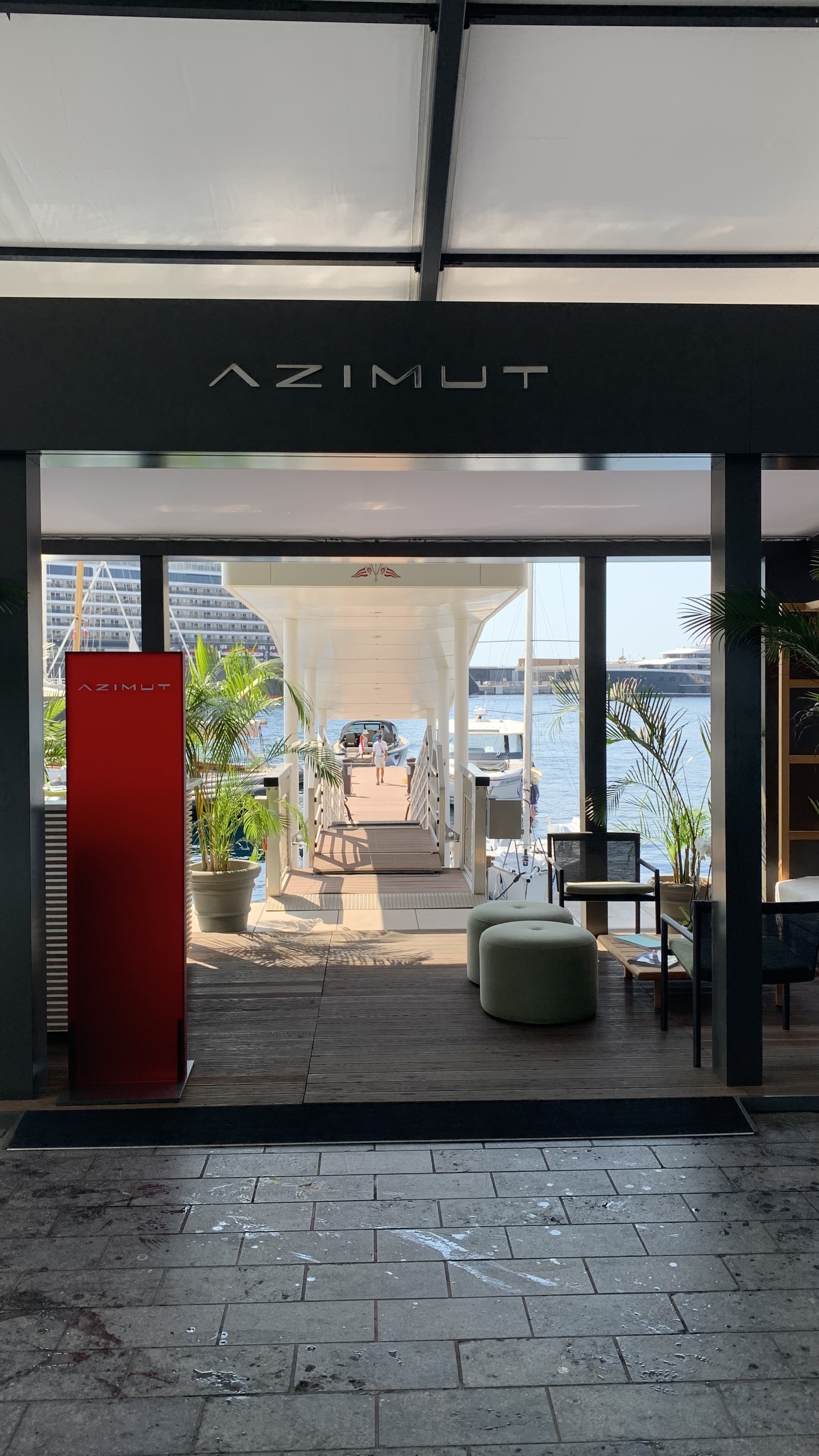
Quai des États-Unis — access to the Azimut pontoon.
Evidence: Photograph · THR
VAM Dimensions: A1
SECP Status: Reviewed absence SE1. Controlled access was interpreted in the context of its harbour function and did not confirm this mechanism in the final record.
© Xavier Reinaldo-Virgili · Monaco Visual Fieldwork Archive
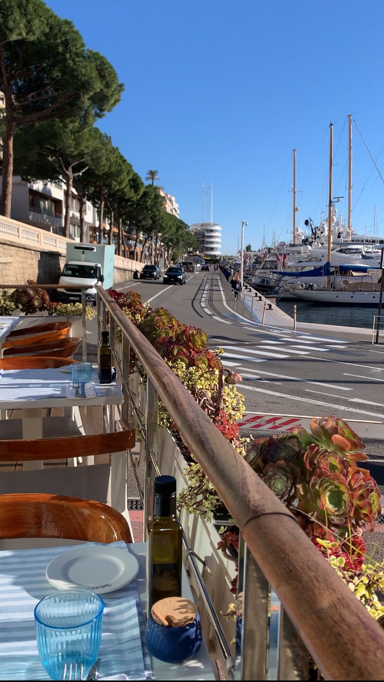
Quai des États-Unis — promenade facing terraces and commercial consumption areas.
Evidence: Photograph · CTX
VAM Dimensions: V1 · V2 · V3 · V4
SECP Status: Reviewed absence SE4. The aesthetics or visibility of consumption did not automatically establish Visual and Symbolic Signalling.
© Xavier Reinaldo-Virgili · Monaco Visual Fieldwork Archive
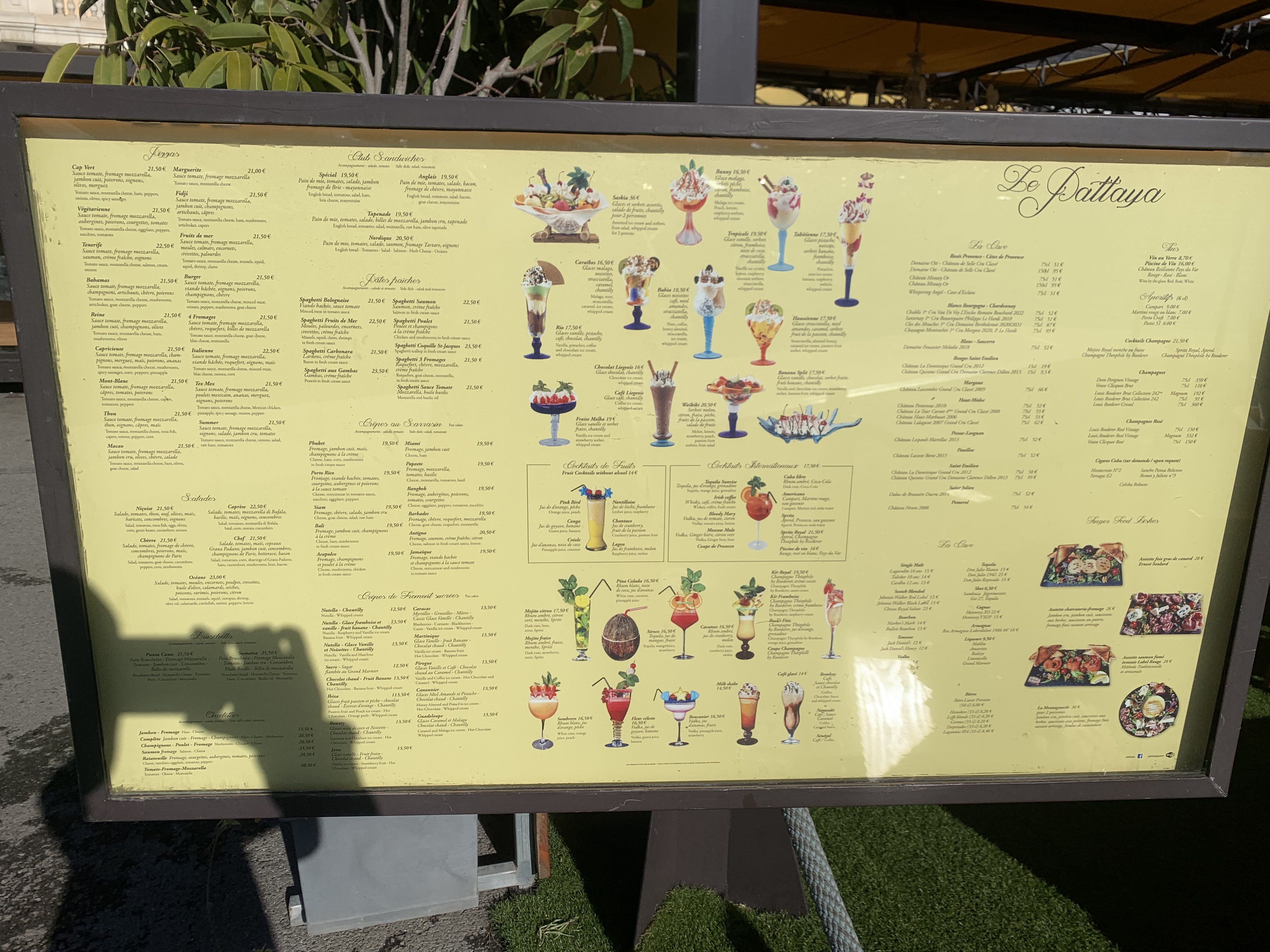
Le Pattaya — menu with visible prices.
Evidence: Photograph · PRC
VAM Dimensions: A2
SECP Status: Confirmed SE6.
© Xavier Reinaldo-Virgili · Monaco Visual Fieldwork Archive
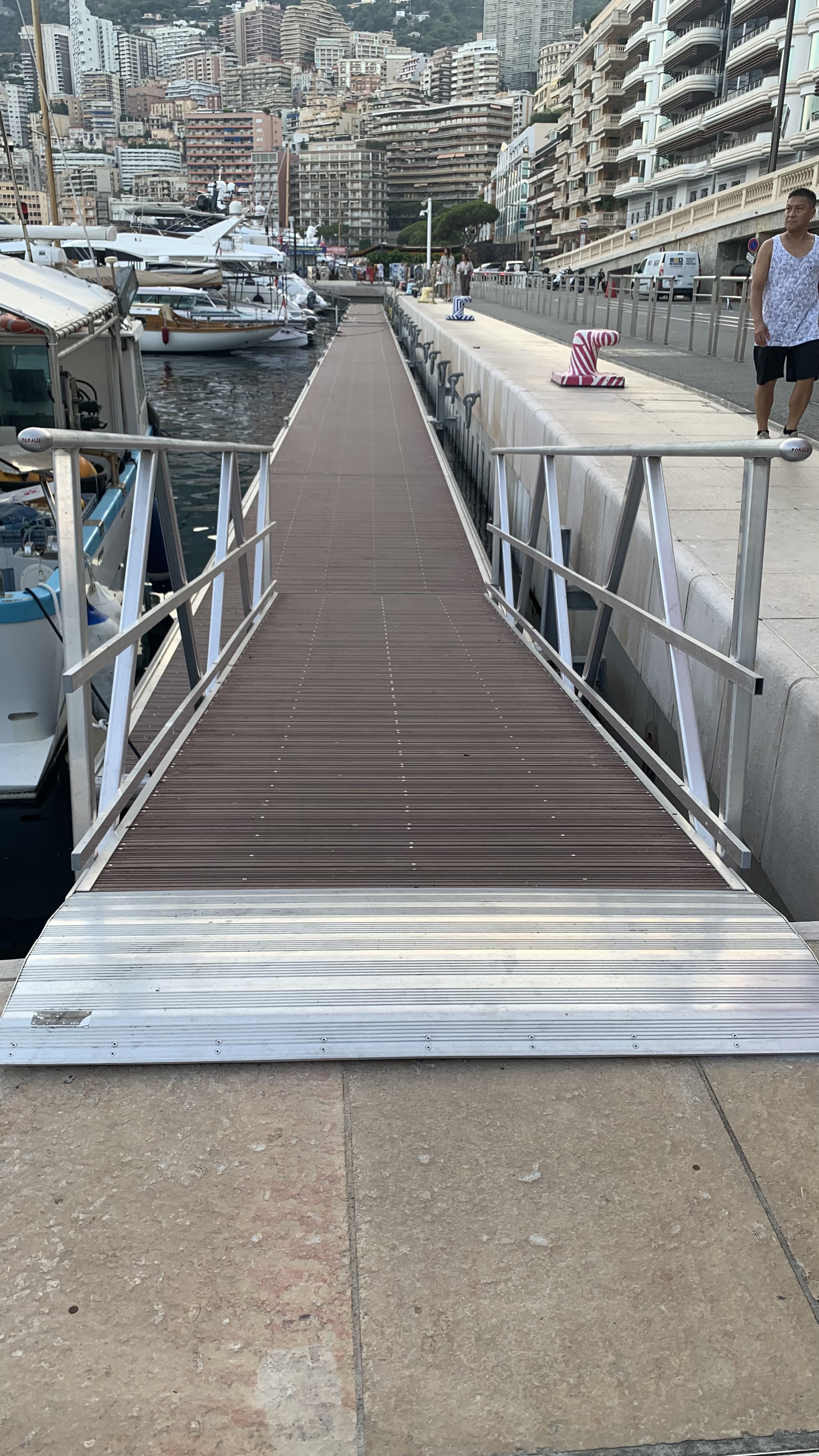
Quai Louis II — physical access control for the marina or pontoon.
Evidence: Photograph · THR
VAM Dimensions: A1
SECP Status: Confirmed SE1.
© Xavier Reinaldo-Virgili · Monaco Visual Fieldwork Archive
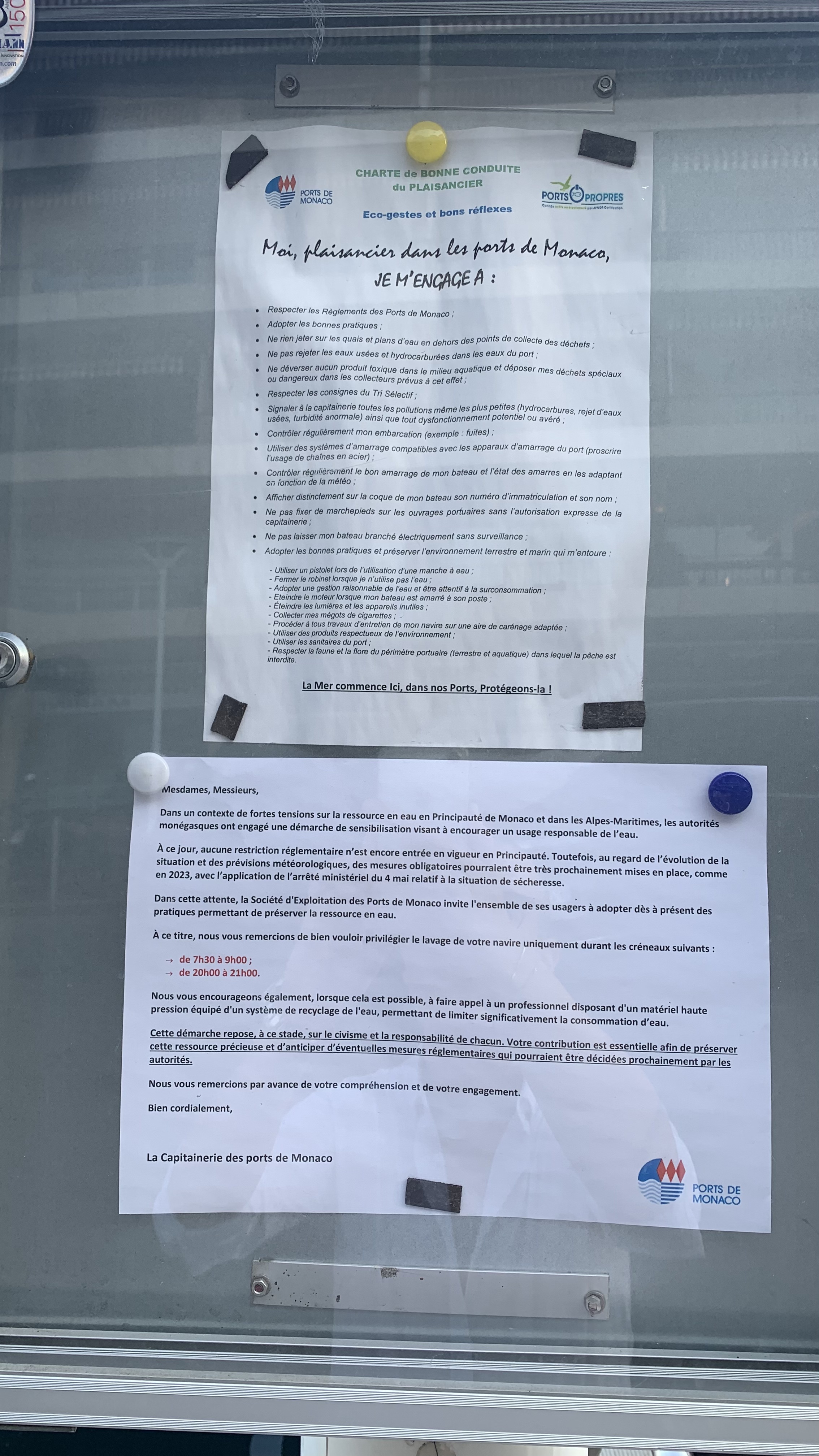
Port Hercule — regulation of secondary pontoon access.
Evidence: Photograph · RUL
VAM Dimensions: A3 · A4 · A5
SECP Status: Confirmed SE5 · SE11 · SE12; Reviewed absence SE10.
© Xavier Reinaldo-Virgili · Monaco Visual Fieldwork Archive
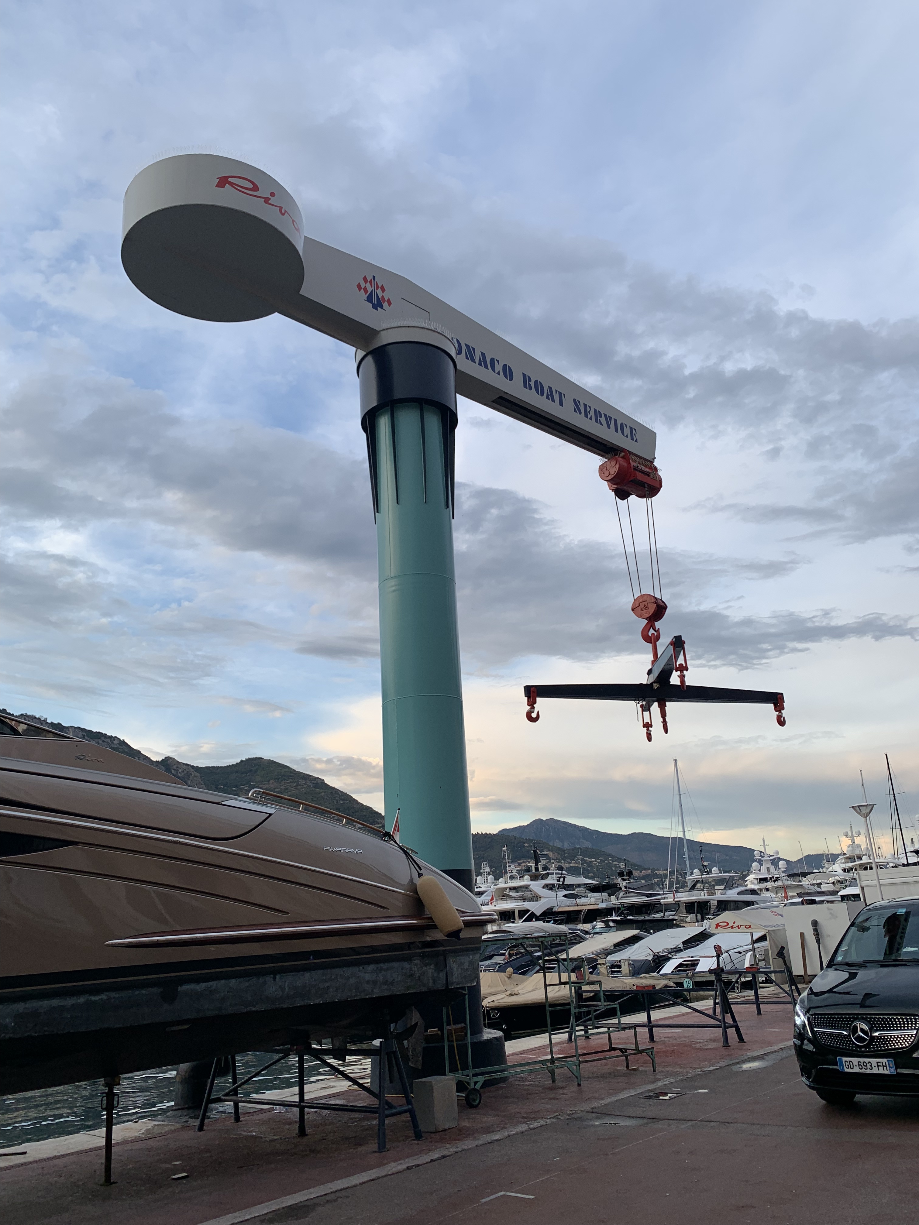
Quai Antoine Ier — access and control point.
Evidence: Photograph · THR
VAM Dimensions: A1
SECP Status: Confirmed SE1.
© Xavier Reinaldo-Virgili · Monaco Visual Fieldwork Archive
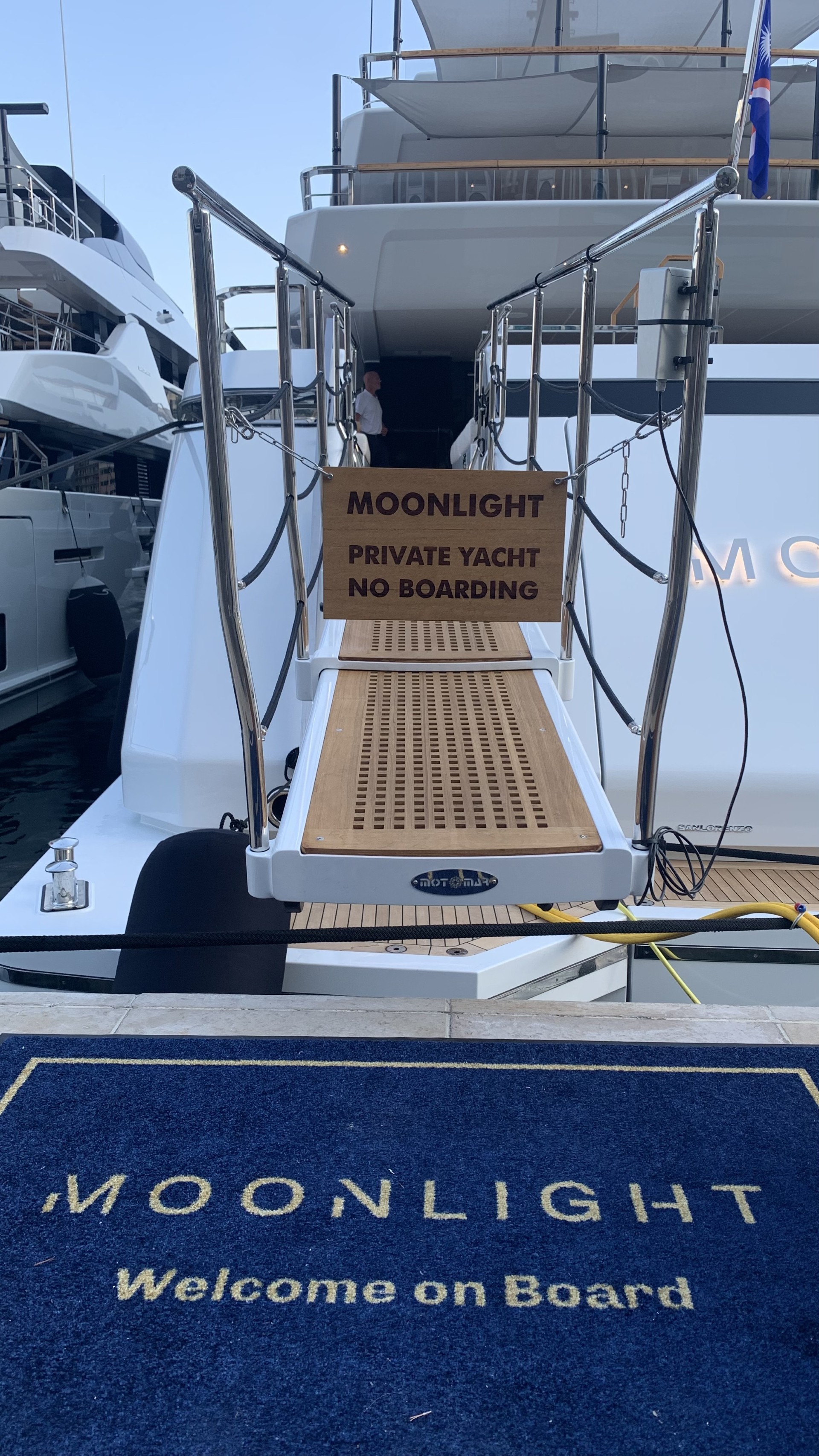
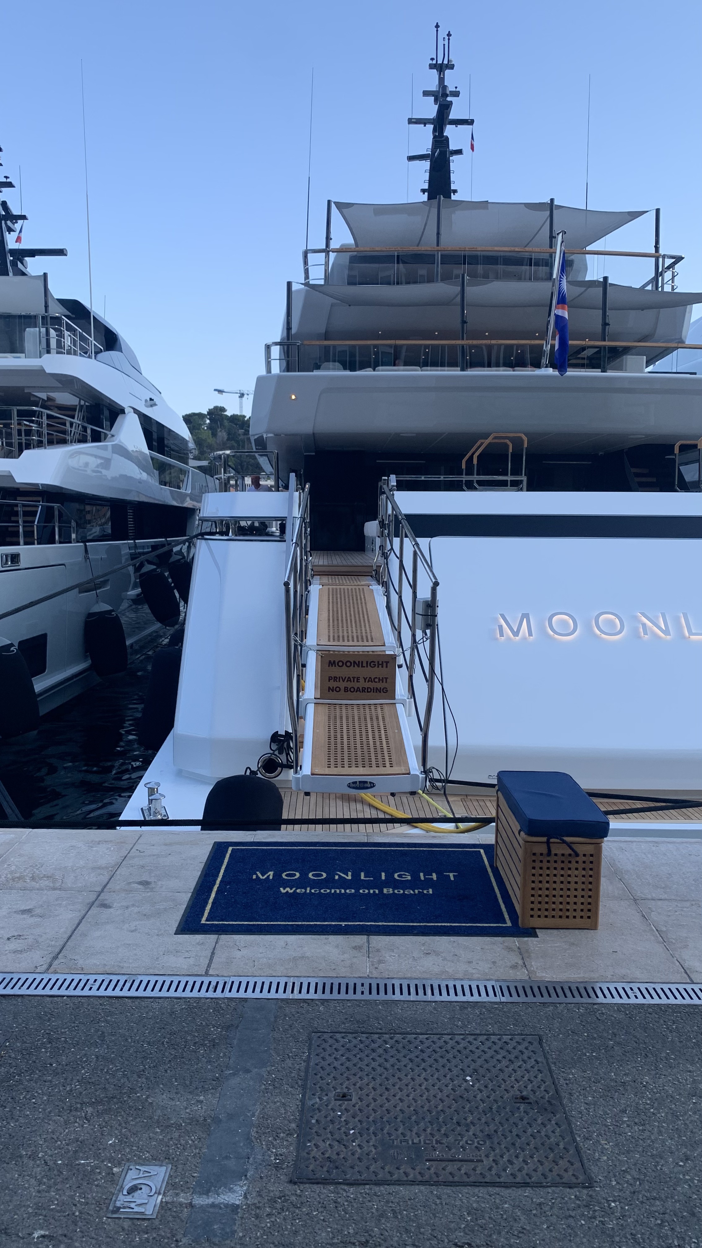
Port Hercule — private yacht access and ownership sign.
Evidence: Photograph · RUL
VAM Dimensions: A1 · A5
SECP Status: Confirmed SE7; Reviewed absence SE5.
© Xavier Reinaldo-Virgili · Monaco Visual Fieldwork Archive
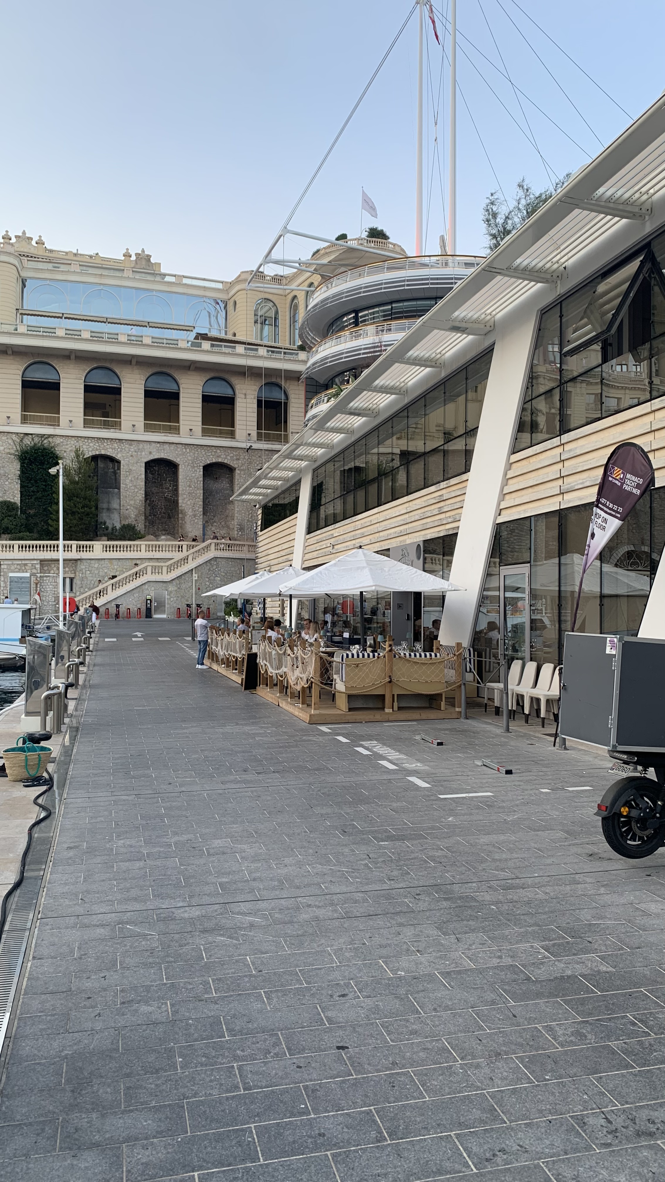
Quai l’Hirondelle — U Luvassu and terrace boundary.
Evidence: Photograph · BAR
VAM Dimensions: A1
SECP Status: Confirmed SE1.
© Xavier Reinaldo-Virgili · Monaco Visual Fieldwork Archive
Selected Video Evidence
Traceable Dynamic Evidence
The 18 video records make it possible to observe routes, mediation, controls and temporary changes that a single photograph cannot fully capture.
Dynamic Evidence 01
Quai Antoine Ier — Public Promenade and Yacht Interface
MVFA-V-2025-PH-000316 · VAM-MC-105 · CTX
Original File: IMG_3813
VAM Dimensions: V1 · V2 · V4 · V5
SECP Status: Confirmed SE4.
The video records the waterfront edge and the visual relationship between the public promenade and vessels. In the final empirical record, it constitutes evidence linked to the confirmation of SE4 for this case.
Dynamic Evidence 02 · Static Preview
Secondary Pontoon Access — Approach Sequence
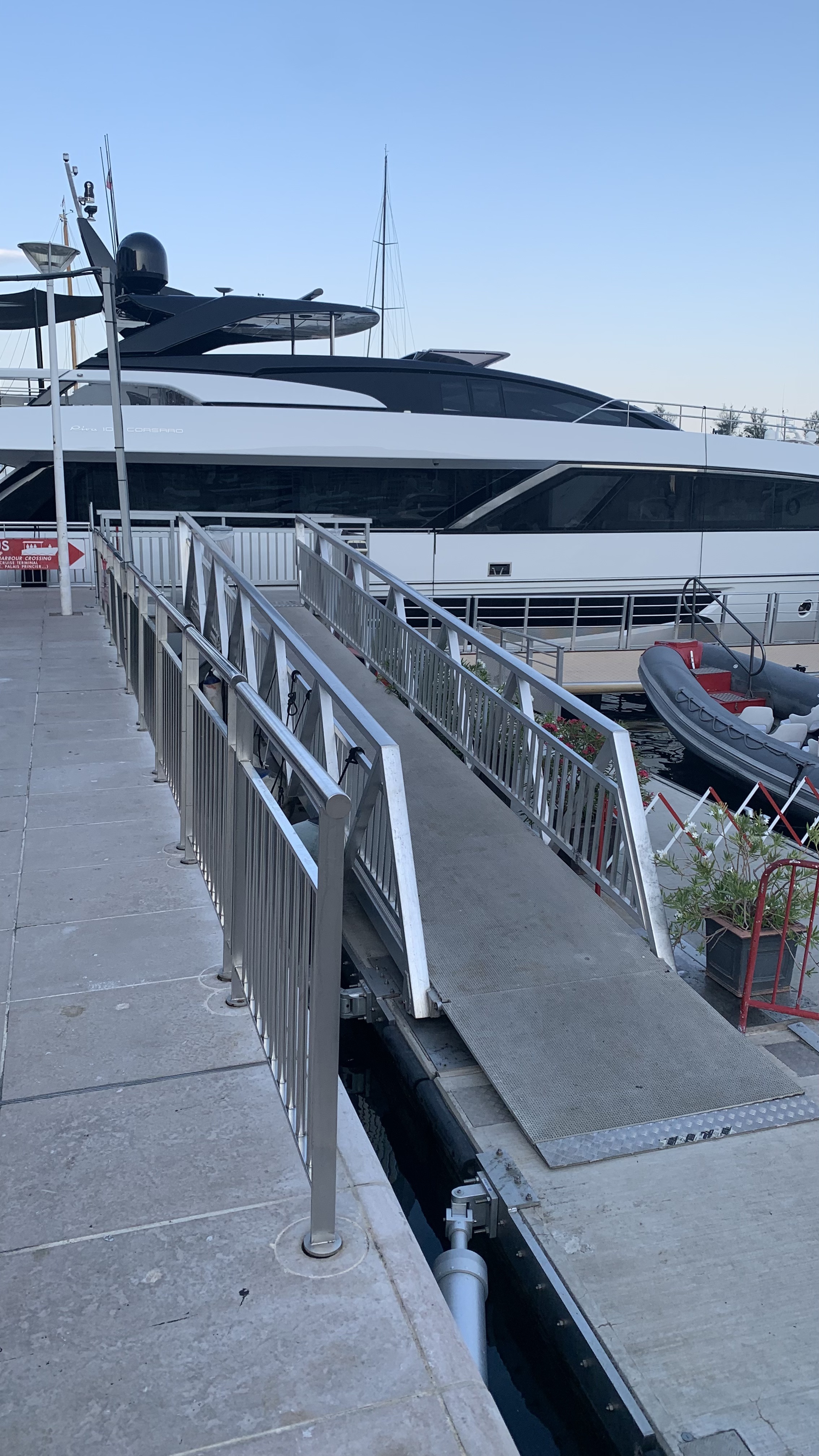
MVFA-V-2026-PH-0104 · VAM-MC-104 · APR
Original File: IMG_8803
VAM Dimensions: V1 · V2 · V5 · A1 · A4 · A5
SECP Status:
Reviewed absence SE2 · SE10.
The inventory classifies IMG_8803 as an approach video running from the public promenade to a secondary pontoon access point. The link currently available on this page points to a JPG image used as a preview of the asset.
Fieldwork Route
Port Hercule Longitudinal Route
The longitudinal route enables comparison of public promenades, visual interfaces with vessels, pontoon access points, commercial spaces and different regulatory systems, without treating the harbour as a homogeneous spatial unit.
Comparative Interpretation
Seeing the Yacht Does Not Mean Accessing the Yacht
Port Hercule has a high mean Visibility = 77.78 and a mean Accessibility = 61.11 also in the High band, but the internal distribution shows that these two properties do not necessarily vary together.
Eleven cases are classified as Publicly Permeable Luxury, while four fall into Displayed but Restricted Luxury. The latter are particularly relevant because they combine high visual exposure with considerably more restrictive access conditions.
The harbour makes it possible to distinguish between observing, approaching, reaching a threshold and crossing it. A gate, an ownership sign, a harbour control point or the presence of security staff does not automatically constitute soft spatial exclusion: SECP requires a relevant assessment opportunity and a reviewed empirical decision.
Research Connections
Data, Methods and Evidence
MVFA–VAM Evidence & Code Guide
Asset ID, Case ID, Evidence Code and VAM dimensions.
SECP Empirical Validation
Validation and rules for interpreting the protocol.
Monte Carlo Research Lab
Overall framework of research instruments and lines of inquiry.
Monaco Spatial & Visual Atlas
Atlas Home · Place du Casino & Carré d’Or · Yacht Club de Monaco · Monaco-Ville · Le Rocher · Larvotto · Fontvieille

