Territorial frameworks for organising the spatial, visual and tourism-related fieldwork conducted by the Monaco Research Observatory.
Spatial Research Framework Territory as research infrastructure
The Spatial Fieldwork Areas are broad territorial units used by the Monaco Research Observatory to organise repeated fieldwork, visual documentation and different lines of research carried out in Monaco.
Their purpose is to provide relatively stable spatial contexts in which places, routes, architecture, infrastructure, observable behaviour, photographs, videos and transformations documented over time can be related to one another.
The areas are not necessarily intended to reproduce official administrative divisions. They form a spatial research infrastructure designed to preserve the territorial context of observations and facilitate comparison.
PLACE → FIELDWORK → EVIDENCE → RESEARCH → OUTPUT
01 · Spatial Fieldwork Areas What constitutes a fieldwork area?
A Spatial Fieldwork Area is a selected territory used to organise observations made at different times and through different types of evidence.
The same area may be relevant to research on tourism, hospitality, luxury, heritage, mobility, waterfronts, public space, visual culture, observable behaviour or change over time, without being limited to a single question or methodology.
Spatial Fieldwork Area ≠ Official Territorial Boundary
Spatial Fieldwork Area ≠ Single Research Method
Spatial Fieldwork Area ≠ Exhaustive Observation
02 · Spatial Research Why organise research territorially?
Tourism does not take place in the abstract. It unfolds in specific spaces whose routes, access points, infrastructure, architecture, landscapes and visual conditions form part of the context in which the tourism experience occurs.
Working with relatively stable areas makes it possible to repeat observations, compare different moments, relate photographs and videos, and connect distinct projects to the same territory without separating evidence from its spatial context.
03 · Selection Criteria Criteria for defining the areas
The selection of a Spatial Fieldwork Area is based on its usefulness as a stable research context, not solely on its prominence as a tourist destination.
| Tourism Relevance | The presence of activities, routes, infrastructure, landscapes or situations relevant to the study of tourism. |
| Spatial Coherence | The existence of sufficiently clear spatial relationships among the locations included in the area. |
| Research Relevance | The capacity of the territory to contribute to one or more research lines of the Monaco Research Observatory. |
| Visual Observability | The possibility of documenting relevant phenomena through photography, video and spatial observation. |
| Repeated Fieldwork | The availability of repeated observations or the possibility of establishing comparisons between different moments. |
| Analytical Diversity | The ability of the area to support different research questions and perspectives without being reduced to a single function. |
04 · Research Perimeters Boundaries for organising fieldwork
Each Spatial Fieldwork Area uses an MRO Research Perimeter to represent the territory within which fieldwork is organised and observations are contextualised.
These perimeters are research delimitations and must not automatically be interpreted as official administrative, historical or planning boundaries.
Inclusion within perimeter ≠ equal fieldwork coverage
Area ≠ exhaustive territorial observation
Spatial Overview Research Areas of Monaco
The overview map locates the five areas currently used as the main territorial fieldwork frameworks within the Monaco Spatial & Visual Atlas.
Cartographic representation of the principal perimeters used to organise spatial fieldwork for the Monaco Research Observatory.
|
Place du Casino · Carré d’Or
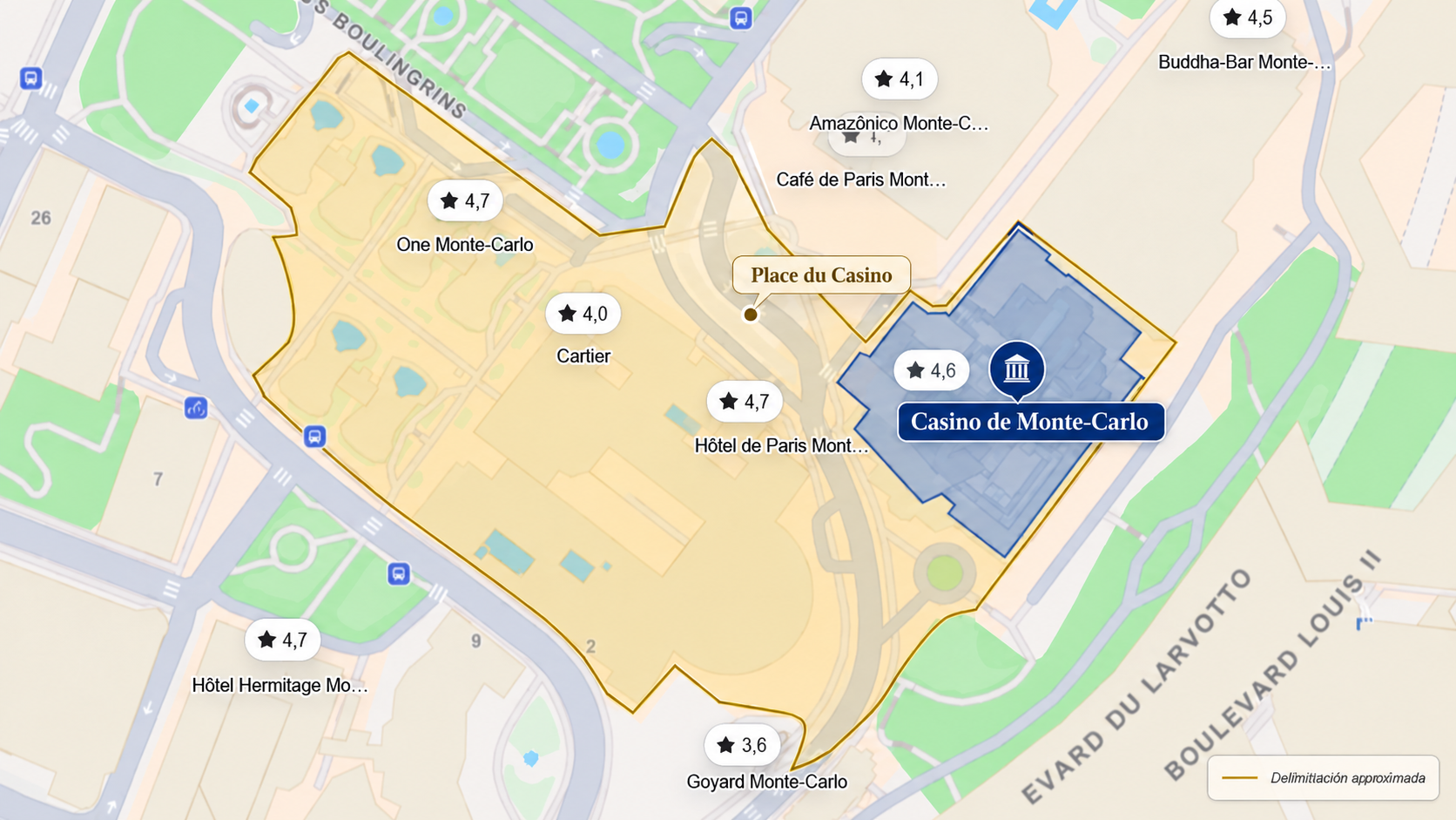
Research perimeter.
Place du Casino and the surrounding Carré d’Or area. |
Port Hercule
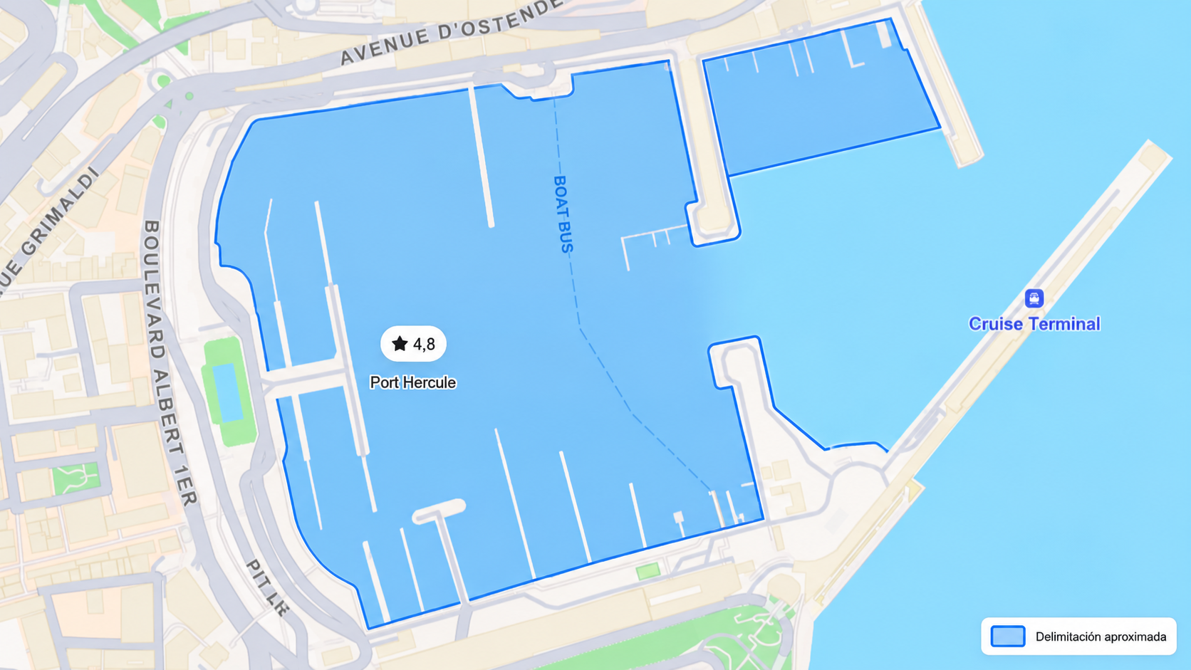
Research perimeter.
Port Hercule and the associated waterfront. |
|
Monaco-Ville · Le Rocher
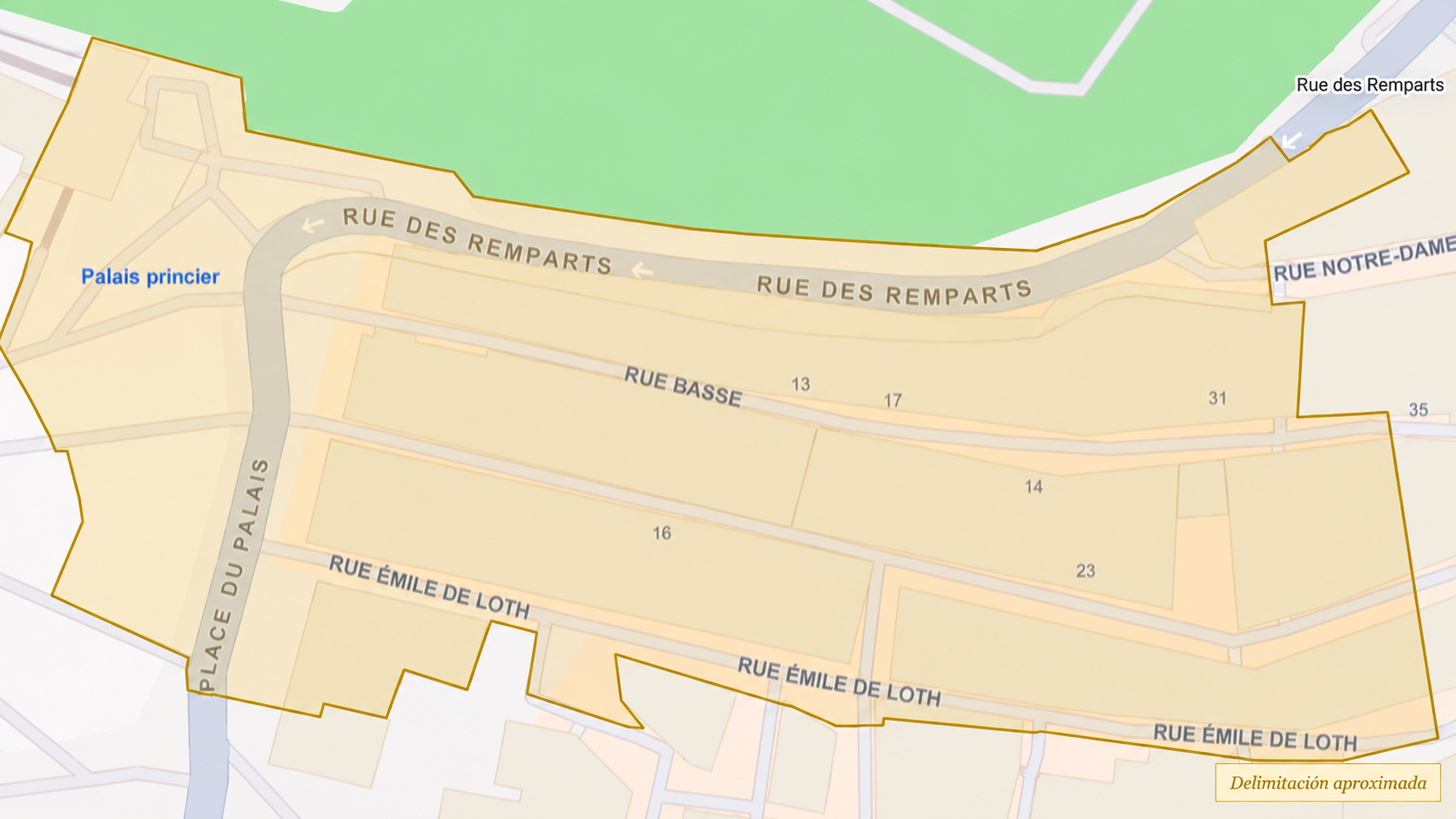
Research perimeter.
Monaco-Ville and Le Rocher. |
Fontvieille
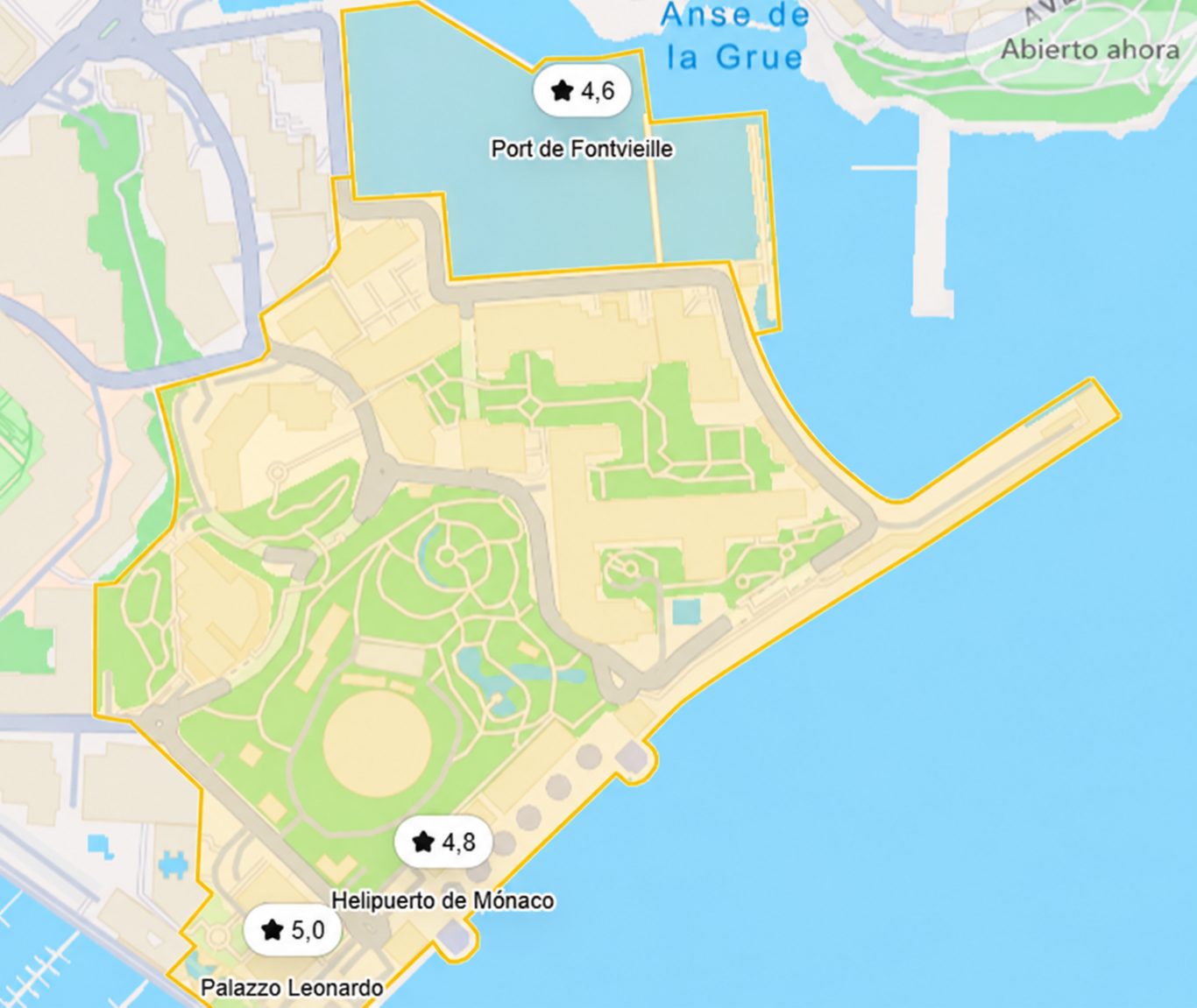
Research perimeter.
Fontvieille and the associated harbour area. |
05 · Spatial Fieldwork Areas Explore the areas
The five areas represent different territorial contexts and make it possible to study diverse forms of tourism, mobility, observation, use of space and urban transformation.
|
Spatial Fieldwork Area · CD
Place du Casino &
|
Spatial Fieldwork Area · PH
Port Hercule
Waterfront · Yachting · Mobility · Tourist Observation
A harbour waterfront where tourism, yachting, maritime mobility, public space, observation and the visual representation of the nautical and luxury landscapes intersect. Explore Port Hercule → |
|
Spatial Fieldwork Area · RO
Monaco-Ville /
|
Spatial Fieldwork Area · FW
Fontvieille
Urban Transformation · Mobility · Infrastructure · Waterfront
A mixed-use area for studying territorial transformation, infrastructure, mobility, waterfronts and the integration of tourism into a functionally diverse urban space. Explore Fontvieille → |
Larvotto
A coastal area for investigating beachfront spaces, leisure, hospitality, lingering, mobility, accessibility and different forms of use of public space and the seafront.
Explore Larvotto →06 · Comparative Perspective One territory, different research contexts
| Area | Spatial context | Research emphasis |
|---|---|---|
| Place du Casino & Carré d’Or | Ceremonial and luxury core | Luxury · hospitality · retail · observation |
| Port Hercule | Waterfront and harbour | Yachting · mobility · public space |
| Monaco-Ville / Le Rocher | Historic and institutional | Heritage · routes · topography |
| Fontvieille | Transformed, mixed-use territory | Mobility · infrastructure · urban transformation |
| Larvotto | Coastal and recreational waterfront | Coastal tourism · leisure · hospitality |
07 · Evidence Base Monaco Visual Fieldwork Archive
The Spatial Fieldwork Areas draw on photography, video and spatial observation produced through repeated fieldwork in Monaco between 2017 and 2026 and organised within the Monaco Visual Fieldwork Archive (MVFA).
The archive preserves the relationship between territory, visual evidence and research use, facilitating the retrieval of materials from different periods and locations.
08 · Research Dimensions Multiple research lines within the same territory
A Spatial Fieldwork Area can contribute simultaneously to different dimensions of the Observatory’s research programme.
|
Tourism Tourism activity, circulation and experience. |
Luxury Landscapes Visibility, materiality and representation of luxury. |
|
Hospitality Hotels, restaurants and service interfaces. |
Heritage Heritage, historic architecture and institutional space. |
|
Waterfront & Yachting Seafronts, harbours and the nautical landscape. |
Urban Space & Mobility Access, circulation, routes and infrastructure. |
|
Visual Culture & Iconography Symbols, materials, architecture and visual representation. |
Temporal Transformation Continuity and change through repeated fieldwork. |
09 · Repeated Fieldwork 2017–2026
Maintaining relatively stable territorial areas facilitates the comparison of observations made at different times and the study of continuities, physical modifications, changes in use, temporary configurations and landscape transformations.
The value of repeated fieldwork lies not only in accumulating images, but also in relating observations separated in time within the same spatial context.
10 · Methodological Limits How to interpret the areas
Visual evidence ≠ exhaustive territorial coverage
Visible behaviour ≠ inferred motivation
Spatial difference ≠ demonstrated intention
Repeated observations ≠ continuous monitoring
Visual selection ≠ statistical representation
11 · Research Connections Connections within the Monaco Research Observatory
|
Visual Research
Monaco Visual ObservatoryVisual Notes · Visual Collections · Monaco Through Time · Video Fieldwork |
Archive
Monaco Visual Fieldwork ArchiveEvidence · provenance · organisation · traceability |
|
Quantitative Research
Monaco Data ObservatoryStructured data · indicators · quantitative context |
Research
Monte Carlo Research LabConceptual research · Research Notes · analytical development |
Spatial Fieldwork Areas as research infrastructure
Spatial Fieldwork Areas are not merely places that are studied. They function as the territorial research infrastructure of the Monaco Research Observatory.
They connect territory, fieldwork, visual evidence, temporal comparison and different research questions within a common framework, while preserving the spatial context of what is observed.

